Environment
8 images from space that show how our earth has changed
Our earth is changing much more rapidly than you might think. NASA has released a series of before and after photos taken from space in a campaign called “Images of Change” showing how different the earth looks now compared to just a few decades ago. Some of these changes are due to global warming, but some aren’t, says NASA’s website. Some of these visible effects are quite alarming.
Here are the most shocking images from space that show how our earth has changed.
Shrinking Great Salt Lake, Utah
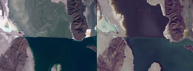
Image: NASA
November 2, 2011 – November 13, 2015
The water level of this part of the Great Salt Lake in Utah has reached a record low of 4191.6 ft. The water from the right arm pictured is pumped into evaporation ponds where salt, potassium and other minerals are then extracted.
Shrinking Ellesmere Island ice caps, Canada
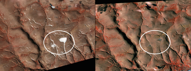
Image: NASA
July 12, 2004 – August 4, 2015
Two ice caps north of St. Patrick Bay, on Ellesmere Island in Nunavut, Canada have shrunk significantly in the past eleven years. These particular ice caps are thought to have begun forming about 5,000 years ago.
New island appears, Red Sea
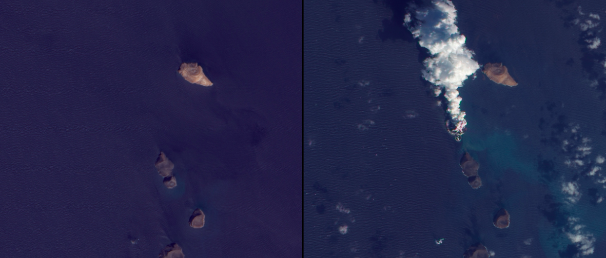
Image: NASA
October 24, 2007 – December 23, 2011
A volcano erupted in the Red Sea in December 2011 apparently creating a new island in its place. Fishermen around the area witnessed lava eruptions blasting up to 100 ft. into the air. A thick cloud of volcanic ash and water vapor can be seen in the image on the right at the time of eruption.
Melting Qori Kalis glacier, Peru

Image: NASA
July 1978 – July 2011
Qori Kalis is the largest outlet glacier of the world’s largest tropical ice cap, the Quelccaya Ice Cap. When the photo on the left was taken, the glacier was still advancing. But by 2011, the glacier had melted completely back onto the land creating a lake in its place, pictured to the right.
Shrinking Aral Sea, central Asia
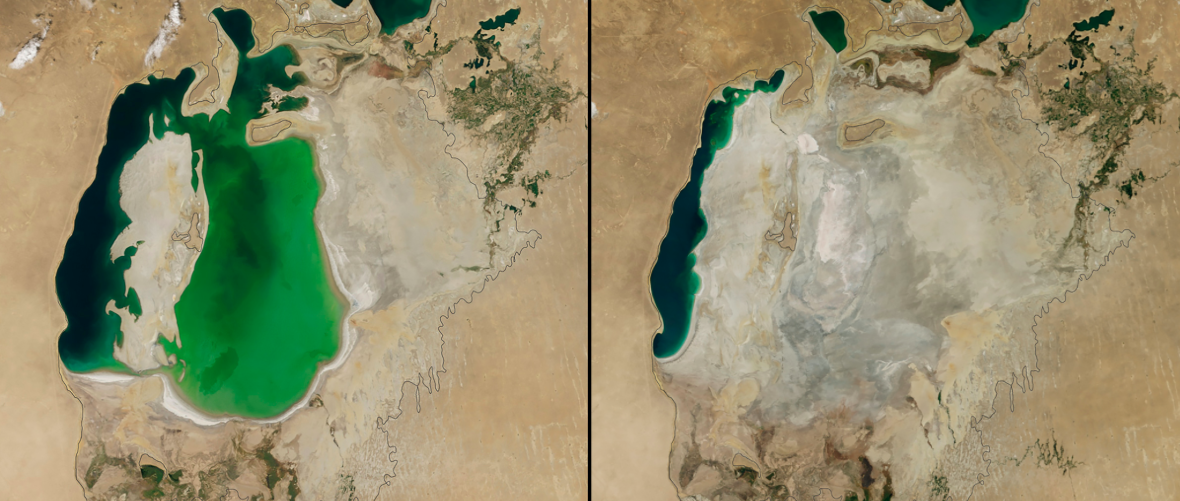
Image: NASA
August 25, 2000 – August 19, 2014
The Aral Sea was the largest lake in the world until the 1960s when the Soviet Union diverted water from the rivers that fed the lake so cotton and other crops could be grown in the arid plains of Kazakhstan, Uzbekistan and Turkmenistan. A dam built in 2005 helped recover a lot of the water loss by taking from the southern sea. However, dry conditions in 2014 caused the southern sea’s eastern lobe to dry up completely for the first time in modern times.
Typhoon Nari flood, Cambodia
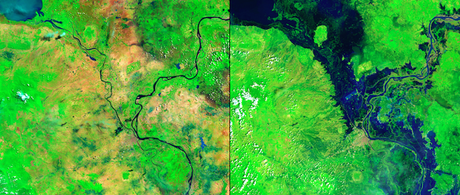
Image: NASA
May 17, 2013 – October 24, 2013
In October 2013, Typhoon Nari followed heavy seasonal rains to create lots of dangerous flooding along the Mekong and Tonlé Sap Rivers in Cambodia. This affected more than half a million people and more than 300,000 hectares (about three-quarters of a million acres) of rice fields are believed to have been destroyed.
Agricultural impact in Aimogasta, Argentina
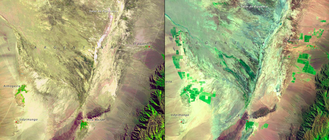
Image: NASA
June 18, 1975 – March 15, 2008
Aimogasta is a regional center of olive production, trade and tourism. Increased agricultural production in this area has created elevated wind and water erosion, salinization, and loss of biodiversity. These photos show the development of the land for these agricultural purposes.
The Coteau des Prairies flood, South Dakota
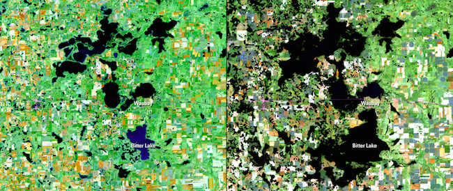
Image: NASA
October 11, 1991 – October 2, 2011
The Coteas des Prairies is a plateau with many small lakes created by repeated glaciation in northeastern South Dakota. In the past two decades, higher and higher lake waters have been swallowing up farm fields, pasture ranges, roads and homesteads. These lakes have no southern outlet for the water to flow out, so they continue to flood surrounding land.


0 comments