
Adventure Travel
The 5 Best Hikes In The Great Smoky Mountains
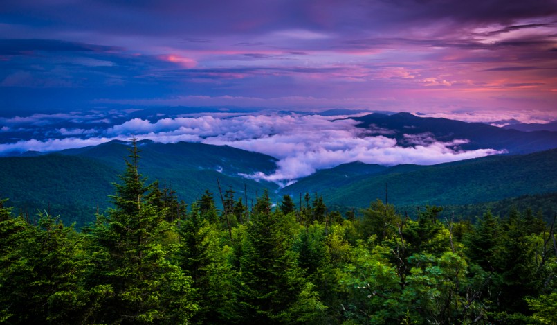
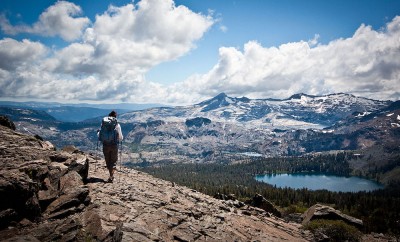
Image: Shutterstock/Jon Bilous
The 5 Best Hikes In The Great Smoky Mountains
Great Smoky Mountain National Park is a diverse ecological wonderland bordering the states of Tennessee and North Carolina. Encompassed within the Appalachian Mountains, the Smokies receive an annual visitation by more than 9 million people who come to enjoy the pristine trails and mystical rolling mountains.
If you’re new to exploring the Smokies, here is a list of the five best hikes in the Great Smoky Mountains. These trails take you through dense, old growth forests, over rocky ridge tops, and across ferny valley floors.
Whether you’re a novice or an expert, there’s a trail for you in the Smokies. Ready to begin planning your trip? Start with these five best hikes in the Great Smoky Mountains.
Alum Cave Trail to Mt. LeConte
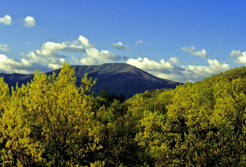
Image: Shutterstock/Jerry Whaley
A quintessential hike in the Smoky Mountains, the Alum Cave Trail to Mt. LeConte is traversed by thousands of adventurers each year. The draw is diverse geography, stunning views, and bizarre history that dates back to the Civil War. It’s not the longest hike in the Smoky Mountains (at 5.5 miles), but the short mileage makes it more accessible for less experienced guests. And if measured from base to summit, Mt. LeConte is actually the “tallest” mountain in the Smoky Mountains, although Clingman’s Dome reaches a higher elevation.
Alum Cave has been an established salt mine since 1838, when the Epsom Salts Manufacturing Company set up shop until it was sold in 1854. During the Civil War, the cave was used by the Confederate Army to mine saltpeter to manufacture gunpowder.
To access the trailhead, drive 8.7 miles past the Sugarlands Visitor Center on Newfound Gap Road. Arrive early during peak season to secure a spot in one of two parking areas on the left side of the road. The spaces fill up quickly on nice weekends!
The trail begins by leading towards Arch Rock at a moderately gentle grade. At only 1.3 miles in, hikers will come to the winding steps etched into the rock. The trail actually comes up through the arch that was formed over centuries of freezing and thawing, which eroded the softer rock.
The next landmark on the trail is at 2 miles, where you will find Inspiration Point and it’s namesake views of Little Duck Hawk Ridge to the west and Mt. LeConte’s Myrtle Point towards the northeast. Carry on for a tenth of a mile to gain a stunning view of Little Duck Hawk Ridge’s “Eye of the Needle,” a small hole that’s cut right through the rock.
Next, hikers come to Alum Cave at 2.2 miles. Interestingly enough, Alum Cave isn’t actually a cave at all! Instead, it’s a 500-foot concaved bluff, which drips water in the spring and creates giant precarious icicles in the winter. Cold weather hikers beware!
For the last two miles, the trail passes over several steep rockfaces and waterfalls. Many have ropes to help navigate the terrain, but extreme caution should be taken at these points.
At 5 miles in, the Alum Cave Trail T’s into the Rainbow Falls Trail, where hikers should turn right. You’ll pass the LeConte Lodge, but must hike another half mile to reach the true summit of the mountain.
A steep, rocky outcropping marks the summit of Mt. LeConte. A beautiful place to take pictures of the surrounding Smoky Mountains, Mt. LeConte’s summit is pristine at any time of the year. Just be wary of slippery rocky during the wet winter months—ice and snow build up easily at these altitudes!
Mt. Cammerer

Image: Shutterstock/MarkVanDykePhotography
Mt. Cammerer is famous for its epic panoramic views from the historic fire tower built atop the summit. The 11.1 mile loop is tedious at points, but the reward is definitely worth it.
The trailhead is in Cosby Campground, which is accessed by turning east onto Highway 321/73 at the junction of 441 and 321 in Gatlinburg. Drive 18.2 miles until the T at Highway 32, where you should turn right towards Cosby. The park entrance is 1.2 miles away, but keep driving another 2.1 miles past that to reach the Cosby Campground entrance. You’ll find the parking area and trailhead just to the left of the campground entrance.
The route begins on Lower Gap Trail and continues for 3 miles until meeting the Appalachian Trail. Fortunately the first section is short, but it’s absolutely the most strenuous portion of the hike (ascending more than two thousand feet.) Switchbacks through dense forests lead you up the Crosby Creek Valley, finally meeting the Appalachian Trail. Turn left at this junction.
For less than a mile, the trail continues on uphill. It’s not as steep as the first portion and it levels off at around 3.7 miles from the trailhead. It only gets easier from there as you hike along a ridge that allows views of the beautiful valleys below.
Look for a spur trail at 5 miles, which will take you to the rocky outcrop where Mt. Cammerer’s fire tower rests. Take it easy on the last portion, which is quite rugged.
The outlook from the fire tower is completely 360 degrees, some even claiming it’s the best view in the entire park! Towards the south you can see Mt. Sterling, the rest of the Smokies in the southeast, and Snowbird Mountain across the deep gorge.
The fire tower was built in the late 1930s by the Civilian Conservation Corps and local laborers as a means of keeping watch over the mountains during high fire seasons. In fact, it was consistently manned from February 15th to May 15th and October 15th to December 15th each year while it was in use.
To finish the loop, stay on the Lower Mt. Cammerer Trail all the way back to the Cosby Campground parking lot. It’s a long day, so be sure to start early!
Shuckstack Firetower

Image: Shutterstock/Dave Allen Photography
The Shuckstack Fire Tower gleams like a beacon for hikers who desire to reach its rickety heights. Constructed in 1934 by the Public Works Administration, the tower’s impressive 78 stairs wind upwards, peaking at a small wooden building on top. As hikers ascend the spiraling staircase, they’ll feel the ebb and flow of the structure, which was built to give a little in the wind. Don’t be alarmed—the views from the top of the tower are worth the gut-wrenching climb.
To access the Shuckstack Fire Tower, head across Fontana Dam from Bryson City, North Carolina. Take a right at the fork just after the dam, where you will find the trailhead (around .6 miles from the dam).
The Shuckstack Fire Tower is along the Appalachian Trail as it winds northwards into the Great Smoky Mountains. At only 3.5 miles in, visiting the tower makes an extremely rewarding day trip. But if you’re looking for an overnight experience, there are plenty of other trails to keep you busy!
A steep ascent marks the first leg of the trail. In fact, in only the first 2.4 miles, you’ll gain around 2,100 feet. The strenuous hike can be completed by beginners, but plan ahead to take the route slowly. Moderate and expert hikers should have no problem navigating the sharp, uphill trail. Always pack extra water and snacks to remain hydrated and nourished.
At around 2.4 miles, the trail begins to level off. The reward is short lived, however, because the climb (at mile 3) is the steepest yet. Luckily it’s short, so don’t be afraid to push through it! At the top of Twentymile Ridge, you’ll come to a three-way intersection. Look for the route marked with a white “T,” which is the way to Shuckstack Fire Tower. From there, the tower is only a tenth of a mile away.
Climbing the stairs of the tower might seem frightful, but the risk is worth it. When you gather the courage and make the ascent, you’ll be granted a 360 degree view of the surrounding wilderness. From the top, it’s possible to see the Unicoi, Blue Ridge, Snowbird, Nantahala, and the Great Smoky Mountains.
With everything you need for a perfect day trip (climbs, views, adrenaline spikes), Shuckstack Fire Tower is a must-hike in the Great Smoky Mountains. Or better yet, hop on the Appalachian Trail and spend a week in the wilderness!
Charlies Bunion
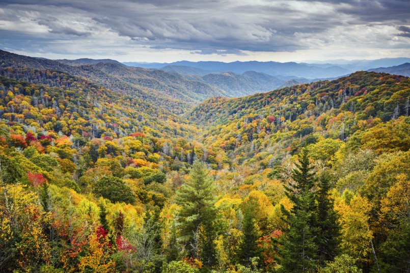
Image: Shutterstock/Sean Pavone
The Smoky Mountains are home to some of the East Coast’s most scenic hikes. The rolling hills of Appalachia evoke an entirely different thrill than the jagged cliffs of the Rockies, while providing dense forests to hide from the summer heat.
Charlies Bunion, an eight-mile roundtrip hike, is a favorite amongst locals who treat the region like an extension of their own backyard. The extremely photogenic and rocky viewpoint is accessed by Newfound Gap Road (around 13 miles from the Sugarlands Visitor Center), the trailhead is located just off of the Newfound Gap parking area.
Heading eastbound along the Appalachian Trail, the hike first takes you over a steady two mile climb, where novices will be left in the dust. Your efforts will be rewarded as the trail continues, when sweeping vistas of the North Carolina Smokies unveil themselves every twist and turn.
At only 1.7 miles in, epic views of Mount LeConte and Myrtle Point are visible towards the northwest. Continue on to glimpse the Icewater Spring Shelter, which is named after a nearby spring that flows from a pipe across the trail. Backpackers note that the shelter is available to book for overnight trips.
As the trail continues on, a marked spur hike (around mile 4) will take you to the rocky outcrop of Charlies Bunion. Be sure to watch your footing—the drop offs are steep during this part of the hike. The elevation is more than 6,000 feet, so you’ll feel like you’re truly at the top of the Smokies!
Once you reach Charlies Bunion, take a moment of pause and observe the surrounding Appalachian Mountains. To the north, it’s possible to see Mt. Kephart, to the west, Jump Off, and to the east, Mount Guyot is in view.
If you’ve still got legs after reaching Charlies Bunion, try taking the one-mile roundtrip side trail to reach Jump Off. Even more stunning views await there!
Gregory Bald

Image: Shutterstock/Carl Ning
While the views from Gregory Bald are spectacular year round, during June and August the meadow truly comes alive. As the wild azaleas bloom in early summer, lovers of the flower travel from all over the world to capture the beauty in it’s peak season. Two types of azaleas from Gregory Bald have even been collected by the British Museum of Natural History, noted for their unique and impressive coloring. In August, wild blueberries cover the meadow. But fair warning—bears love blueberries even more than humans do! Keep an eye out for a furry friend during blueberry season.
The trail is quite complicated to get to, but don’t let that stop you! At the “Y” intersection in Townsend, Tennessee, turn towards the west on Laurel Creek Road (towards Cades Cove.) At 7.5 miles, you’ll reach the Cades Cove parking lot, where you can enter the one-way loop. Around 5.5 miles later, the road will make a steep left and turn into Forge Creek Road. Follow it for 2.2 miles and the parking lot will be just past Parson Branch Road.
Start the trail on the Gregory Ridge Trailhead, which takes you across three footbridges in the first 2 miles. After passing Backcountry Campsite 12, you’ll enter a stretch where a forest fire burned away many of the trees a few years ago. Take a breather at the campsite because the next 3 miles on the trail are intense! You’ll gain roughly 2,000 feet in elevation in the short time.
At 4.9 miles from the trailhead, you’ll meet the Gregory Bald Trail (an easier trek up the mountain), where you should turn right. After a few interchanging steep climbs and flat sections, the final push will take you up onto Gregory Bald.
If you go when the azaleas are in bloom, you’ll be blown away at the stunning variety of colorful flowers that coat the high-altitude meadow. But the views are outstanding any time of the year, so don’t hesitate to make the climb whenever it works for you. You won’t leave disappointed!


1 Comment