
Adventure Travel
Drone’s Footage Of Greenland Ice Sheet Is Groundbreaking, Literally
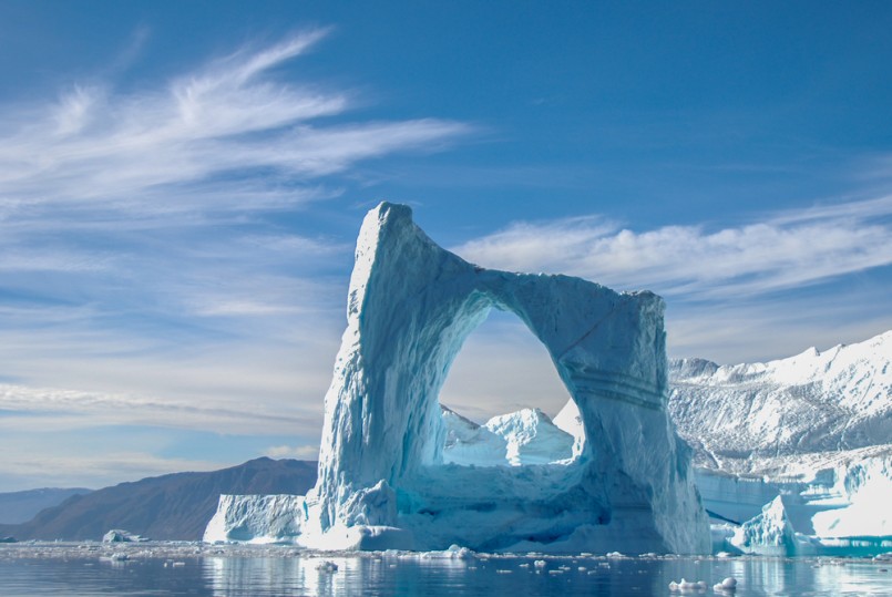
Image: Shutterstock/Henri Vandelanotte
Scientists sitting behind computer screens creating computer models is one way to explain global warming and the process of glaciers melting, but it doesn’t make as much of an impact as photography, specifically drone photography. With clear visual footage, anyone can see what is going on with glaciers in a matter of seconds. Satellites have been tracking melting glaciers for awhile now, but close-up, on-the-ground footage is what we’ve all needed to truly predict just how fast sea levels will rise. A team of researchers has just proven that drones have a crucial importance to capturing the speed of global warming like nothing else before.
The Greenland ice sheet is one of the biggest and fastest-melting glaciers in the world. If the entire ice sheet melted, it would increase sea levels by about twenty feet.
Brandon Overstreet, a doctoral candidate in hydrology at University of Wyoming, and a team of six other researchers focused in on one river on this ice sheet to gather data. This particular river is one of thousands on the ice sheet that are at the forefront of climate change. This river alone has the power to be the most disastrous player in global warming.
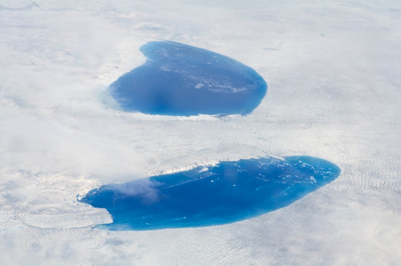
Image: Shutterstock/Francesco Dazzi
As Earth’s temperatures increase, large lakes form in the center of glaciers, which create a network of rivers that spread all across the ice. These rivers melt through the ice like a knife through soft butter. They melt into deep holes called moulins. The moulins drain the river’s water into the ocean. Basically, glaciers are more like Swiss cheese than solid ice formations.
The network of rivers combined with the moulins are tearing apart glaciers rapidly from the inside out.
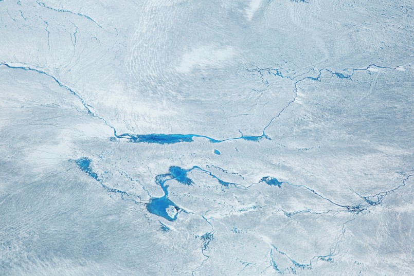
Image: Shutterstock/Milan Petrovic
This team, along with Josh Haner, staff photographer and senior editor for photo technology at The New York Times, used a drone to better capture their findings. The drone’s battery could only last 8-10 minutes in the freezing Greenland air. In that amount of time, Haner was determined to fly the drone from the lake, over the river, down into a moulin, and back. He wanted to get the drone low over the river’s surface—something only a drone could do.
The team discovered that the glacier is melting at accelerating speeds and that 430,000 gallons of water a minute are being poured off the ice and into the moulin, which leads to the ocean.
To learn more about Haner’s experience with using a drone, you can read his story here. With the help of this team, the New York Times also features an interactive map of the river for you to better visualize the researcher’s findings.


0 comments